Remote Sensing
The Water Department queries and downloads remote sensing data from Google’s Earth Engine (EE). Earth Engine is a data archive hosting programmatic access to the world’s largest repository of freely available satellite imagery. With the Earth Engine Python API, a set of customized python scripts send queries and retrieve summarized output for land management units in Owens Valley. The data is both stored in on Google’s servers and the Earth Engine queries are executed on Google’s cloud computing infrastructure, eliminating two obstacles that traditionally has challenged monitoring vegetation change with satellite imagery.
The set of tools used to query Earth Engine is available on GitHub (https://github.com/Map-Water/ee-tools).
Example Output: Parcel BLK094
Daily parcel level data over time. This data includes all Landsat 5/7/8 scenes available over the period 1985-present and averaged over each parcel’s boundaries. Outliers are flagged in yellow. Use the tools to the right of the plots to zoom into a time period or highlight a set of datapoint(s) across plots.
NDVI, Albedo and Surface Temperature from Landsat 5/7/8 over the period 1985-present.
Daily parcel level data against Julian day of year. This data includes all Landsat 5/7/8 scenes available over the period 1985-present and averaged over each parcel’s boundaries. Outliers are flagged in yellow. Use the tools to the right of the plots to zoom into a time period or highlight a set of datapoint(s) across plots.
NDVI, Albedo and Surface Temperature from Landsat 5/7/8 by day of year to evaluate seasonal anomalies over the period 1985-present.
Annual averages
Mean parcel-level NDVI, Surface Temperature and ETo July 15-Sep 15 of each year, 1985-present.

Normalized Difference Vegetation Index (NDVI – surface reflectance Landsat 8) and Precipitation (PPT – GridMET).
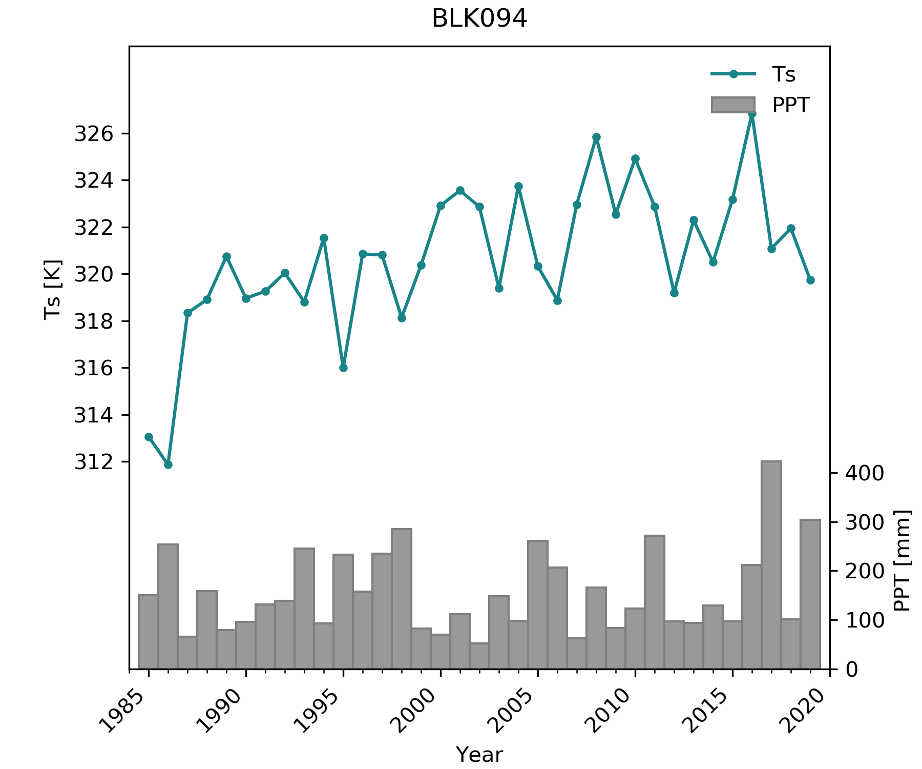
Surface Temperature (Ts – Landsat 8) and Precipitation (PPT – GridMET).
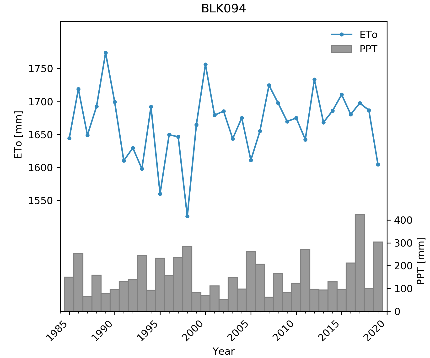
Potential Evapotranspiration (ETo – GridMET) and Precipitation (PPT – GridMET).
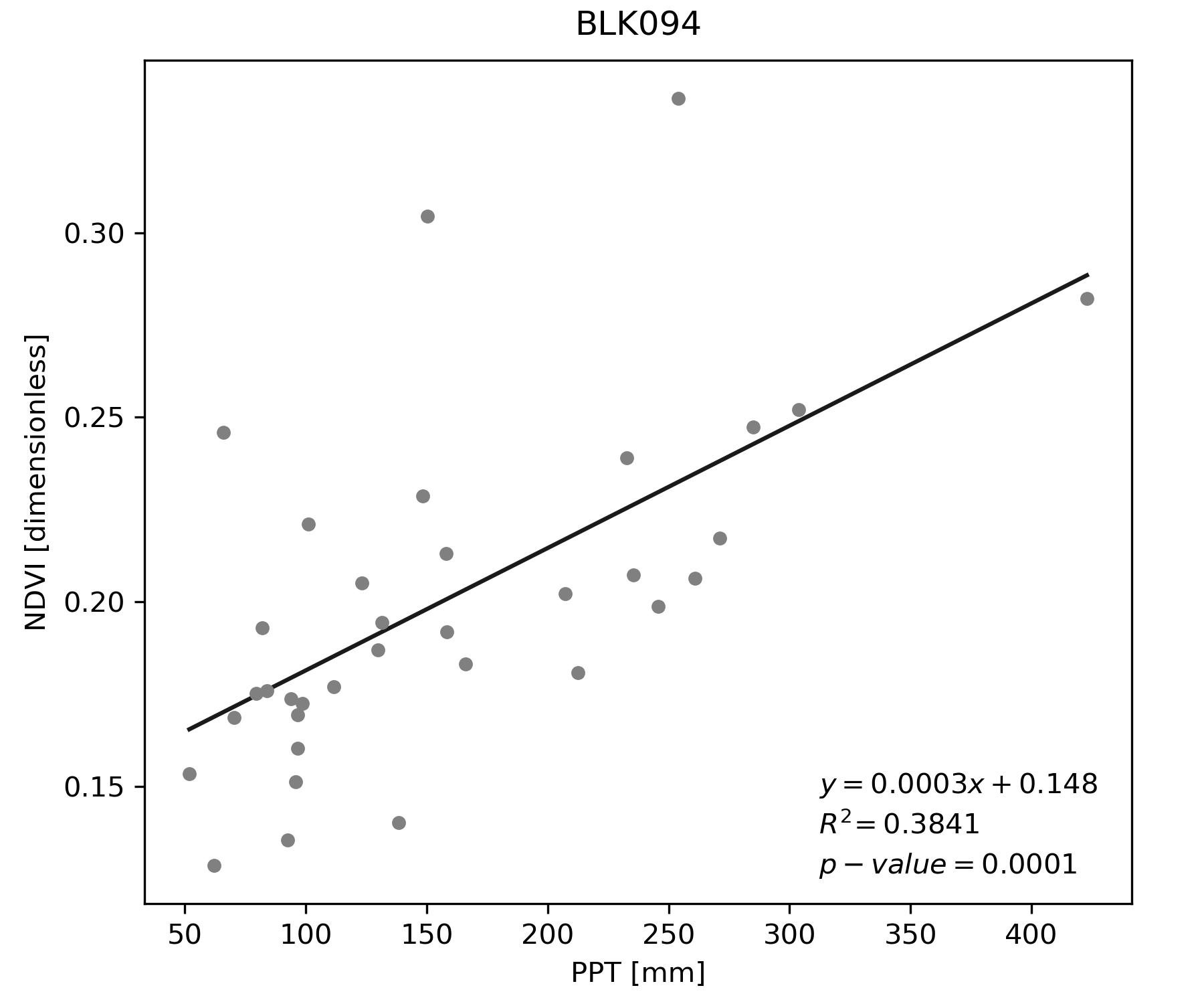
Relationship between Normalized Difference Vegetation Index (NDVI – surface reflectance Landsat 8) and Precipitation (PPT – GridMET).
Change from Baseline
Normalized difference Water Index (NDWI) = (NIR-SWIR1)/(NIR+SWIR1). Difference in July 15-Sep 15 average NDWI in 2019 compared to July 15-Sep 15 average NDWI over the 1984-1987 Baseline period.
Change from Previous Year
Normalized difference Water Index (NDWI) = (NIR-SWIR1)/(NIR+SWIR1). Difference in July 15-Sep 15 average NDWI in 2019 compared to July 15-Sep 15 average NDWI in 2018.